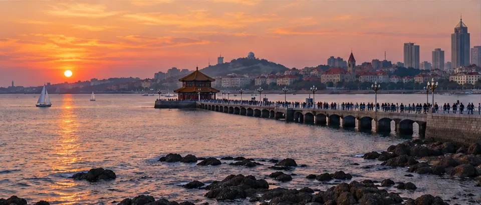















































Badaguan is well suited to exploring on foot, but first-time visitors may mistake “the attractions are clustered” to mean every stretch is flat, adjacent, or directly connected to the sea. The streets, historic buildings, shade, and coastline are in different locations. If you place a few landmarks on a map without checking entrances, walking distances, and slopes, you may double back at intersections or spend time finding your way that you meant to use by the water.
A smoother plan divides the day into neighborhood walks, building visits, and time by the coast, then connects them at a pace that suits your group. Shade can make walking in the sun more comfortable, but it does not mean every section is covered; the sea may look close, but that does not mean every street leads directly to the beach or boardwalk. Before setting out, use the CityTimeDate Qingdao city page to check the local date, then adjust your route for the day’s weather, attraction access information, and actual entrances.
Confirm the Badaguan area and arrival entrance first
Badaguan is in Qingdao’s Shinan District, between Taiping Cape and Huiquan Cape, and its scenic streetscape consists of multiple roads and distinctive historic buildings. Travel guides often list places such as Huashi House, Princess House, or Second Beach, but these are not all at the same entrance, and they may not make a suitable straight-line walking route. Choose the building or coastal area you most want to see, then mark its entrance address, the nearest bus or metro station, and your exit direction. This gives you a clearer sense of the route than searching only for “Badaguan.”
If you get off a metro or bus, also check the actual route from the stop to the neighborhood entrance and whether you need to cross a major road, walk up a slope, or go around to another entrance. Neighborhood names and attraction names may appear together in one itinerary, but that does not mean they are next door to each other. You can divide the walking route into sections in advance, then follow signs on site when you arrive. If construction, access controls, or a temporary crowd changes the route, follow local information rather than insisting on directions from an old screenshot.
Streets, slopes, and walking pace
Comfort in Badaguan depends not only on distance but also on slope, surfaces, and how often you stop. Some streets have elevation changes, and a short stretch on the map may feel more demanding with luggage, a stroller, or a companion who walks slowly. Plan the outing in short sections: walk to a main building or neighborhood intersection, then decide whether to continue to the next stop. If you are also visiting another coastal area that day, leave time for transport and rest instead of packing the landmarks too tightly.
The “shortest route” shown in navigation may not be the easiest route because it may not reflect steps, waits at crossings, construction, or the location of an entrance. Before setting off, check whether the walking route follows main streets, and ask the accommodation or attraction staff which entrance is most suitable. If the return involves an uphill walk, estimate it at your group’s actual pace rather than using the downhill time for the outbound trip. Wet pavement, low visibility at night, and crowds can also affect walking; if needed, take a short ride or end the walking section earlier.
Shade, seasons, and time to spend
Badaguan is known for tree-lined streets and buildings, but the amount of shade depends on street orientation, season, tree conditions, and the weather that day. Do not assume the entire route from the entrance to the coast will be shaded. When the midday sun is strong, schedule longer walks for a more comfortable time and leave room to stop, drink water, or go indoors. If you mainly want to take photos or look at the architecture, you will likely need more time than if you are simply crossing the area, so avoid scheduling the next transport connection too tightly.
Seasonal scenery and crowds also change the walking experience. Flowers, fallen leaves, sea breezes, and rain can affect the streetscape or surface conditions; photos online do not guarantee the same scene on your visit. Design the route as a loop that can be shortened or extended: if the weather is comfortable, stay longer; if it is hot, raining, or your group is tired, turn toward a transport stop or indoor venue earlier. Checking the forecast and same-day attraction notices before leaving is more reliable than relying on a fixed “best time.”
Connecting historic buildings with the coast
You can visit Badaguan’s historic buildings and the coast on the same day, but you still need to connect them on foot or by vehicle. First check whether a building is open to visitors, requires a reservation, or can only be viewed from outside; then decide how long to stay and where to go next. Access to historic buildings such as Huashi House may change according to management arrangements, so do not assume that being able to see the exterior means you can enter at any time. If your main goal is a seaside walk, confirm the usable entrance and same-day access conditions for Second Beach or the coastal path directly.
When connecting the neighborhood and coast, use a simple sequence such as “building streets—rest stop—seaside” to avoid crossing back and forth between streets. The coast may look close, but actual walking can depend on road direction, fences, slopes, and pedestrian entrances. Choose a route using the map and signs on site; do not cross barriers or enter closed areas. If a stretch is not suitable for walking, a bus, taxi, or short transfer can be an alternative, but confirm the boarding and drop-off points in advance.
Planning for older adults, young children, or changing weather
When traveling with older adults, young children, or companions who walk more slowly, first check places to rest, restrooms, accessible entrances, and routes with fewer steps. You cannot determine whether a wheelchair or stroller can pass based only on an accessibility symbol on a map; confirm entrances, slopes, and surfaces with the attraction or service provider. Carrying large luggage is usually not suitable for a long walk through the neighborhood, so store it first and explore with lighter bags. If anyone needs specific assistance, confirm it with the provider before setting out rather than assuming equipment or staff will be available.
If the weather worsens, the sea breeze picks up, or walkers become tired, keep the option to shorten the route. Note the nearest transport stops, available pickup points, and accommodation contact details, and save your itinerary offline in case the network is unstable. If you need to coordinate a change in meeting time, use the date and time features on the CityTimeDate tools page; transport operation, opening hours, and temporary access controls should be confirmed through same-day notices or with the provider.
Further reading and sources
Event dates, opening hours, and transport services may change. Check official updates before you travel.