














































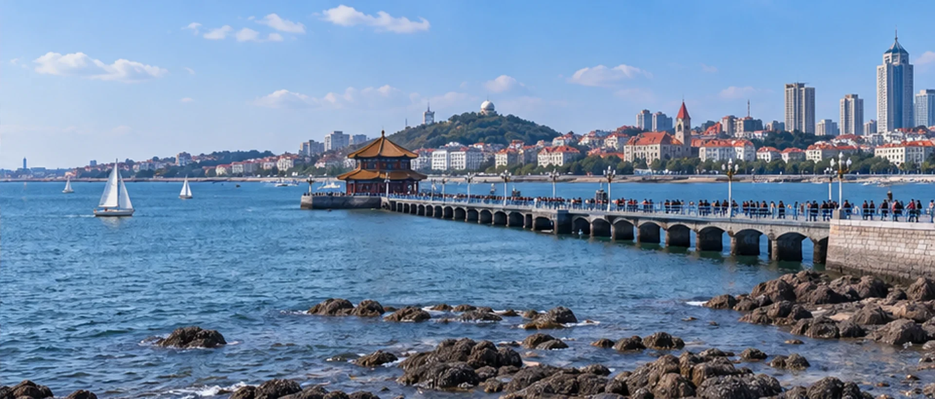
A walk along the Qingdao coast often raises a seemingly simple question: if the sea is right in front of you, why does the sun disappear behind buildings or land at sunset? Sunrise and sunset times tell you when the sun approaches the horizon on a given day; they do not guarantee that the spot where you stand faces the sun. Qingdao’s coastline includes bays, headlands, and stretches of shore facing different directions. The open view from Zhanqiao Pier, Badaguan, and Fushan Bay is not exactly the same. Choosing a date first and checking the direction usually helps more than searching for a single “seaside spot.”
This article offers a method you can use throughout the year to turn daylight information into a walking or photography plan. You do not need to memorize the sunrise minute for a particular day. Instead, confirm the city, local date, viewing direction, and how you will get there. Before leaving, open the CityTimeDate Qingdao city page to check the local date, then look up sunrise and sunset for your chosen date. Only then decide which stretch of coast to visit and how to return to your accommodation after dusk.
Distinguishing sunrise, sunset, and changes in the sky
Sunrise and sunset are astronomical time definitions based on the relationship between the sun and the horizon. The broader changes in the sky include when you can first see your surroundings in the morning or when soft daylight remains in the evening. These are not the same thing. A listed sunset time does not mean every place turns dark at that minute; likewise, there may already be daylight before sunrise. If your goal is simply to walk along the coast, you do not have to schedule your departure for the exact moment the sun appears.
Clouds, atmospheric conditions, and obstructions also affect what you can see. Terrain across a bay, nearby buildings, or a headland may block your view of the sun earlier, without making the city’s listed sunset time incorrect. For photography, distinguish whether you want to capture the sun’s disk, reflections on the water, or a layered sky; each calls for a different setup. Once you define the shot, it is easier to decide whether to move to another stretch of shore or simply change the direction of your camera.
How to read the direction of the Qingdao coast
The southern coast of Qingdao is not one straight line with a fixed orientation. Bays curve inland and headlands jut out; after walking around a single corner, the directions of the sea and land in your view may change. Badaguan lies between Taiping Cape and Huiquan Cape, and not every street in the neighborhood has an open view of the sea. So “near the sea” can be a useful lodging or walking preference, but by itself it does not prove that a spot is suitable for photographing the sun rising or setting over the water.
When looking at a map, first set it with north at the top. Find the specific path or intersection where you plan to stop, check which way it faces the sea, and see whether another stretch of land lies ahead. Sunrise is generally associated with the eastern sky and sunset with the western sky, but the actual direction shifts with the date; do not treat due east or due west as a fixed year-round photo location. If a lookup service provides the sun’s azimuth, compare that direction with the map for the chosen date. A phone compass can help, but recheck it near metal structures.
A step-by-step way to look up daylight information
First, confirm the city rather than relying only on the Chinese place name in a search result. Qingdao may also appear as “Qingdao” or under the older spelling “Tsingtao.” Make sure the page points to Qingdao in Shandong, China, rather than a place with the same or a similar name. Second, select the actual local date when you plan to go out in Qingdao. If you are checking from abroad, the date shown as “today” on your phone may differ from the date in Qingdao; this is especially easy to miss for trips arriving around midnight or on the next day.
Next, check the time zone and time format used in the results. Qingdao uses Beijing Time. If the daylight page labels its times as Qingdao local time, read them using that page’s local date and clock time. Do not mix UTC, your phone’s current local time, and Qingdao time when copying the results. Finally, review the fields for sunrise, sunset, length of daylight, and the sun’s direction, and keep the details relevant to your purpose. For an evening walk, knowing how the light changes near sunset and how you will return is usually more useful than copying an entire astronomy table.
Turning the information into a coastal walk or photo plan
After choosing a walking area near Zhanqiao Pier, the outer edge of Badaguan, or Fushan Bay, plan backward: decide where you want to stop, then work out how long it will take to reach that point on foot or by transit and to find your way. The coastal distance on a map may not equal the actual route from your accommodation, because there may be slopes, intersections, or detours to an entrance. Do not schedule your arrival so tightly that you have no margin just to catch a particular moment of light.
If photography is your goal, confirm your position using a daytime map or an on-site look, then decide how you will return in the morning or evening. Reflections on the water and side lighting on buildings may appear even when you cannot see the full disk of the sun; these can still make worthwhile photographs, so there is no need to insist on the sun “setting directly into the sea.” If your companions simply want to walk and look at the sea, schedule photo stops separately from rest stops so everyone does not have to wait in one place.
Plan the return separately. Do not treat sunset as the exact moment you must leave the coast, and do not let that assumption make you overlook lighting or where to catch a ride. Note a recognizable road intersection or meeting point; it is more useful for finding your way back than saving only a seaside photo. If you need to compare Qingdao time with home or plan an arrival that crosses into another date, continue with the CityTimeDate time and date tools, and save the daylight plan separately from your general transport itinerary.
Adjusting for clouds, strong wind, and travel companions
Daylight times provide astronomical context; they are not a weather forecast. The sun may rise on schedule but remain hidden by thick clouds, while coastal wind and rain can affect how comfortable it is to stay outside. Before leaving, check the destination’s weather information, then use signs, the walking surface, and visibility on arrival to decide whether to shorten your outing. If waiting for the sun is not suitable, switch to a shorter neighborhood walk, an indoor break, or another time for observing the coast. You do not need to stand outside uncomfortably just to complete a photo.
When traveling with children, using a stroller, or accompanying an older adult, prioritize a walkable route and opportunities to rest. Check elevation changes, whether stairs are required, and where you can turn back early. A sea view does not mean every coastal facility has the same accessibility features. If the selected spot does not work for someone in your group, stop at a stretch of shore that is easier for pickup. Sunrise and sunset information should help you plan flexibly, not require everyone to arrive at the same photo spot at an exact time.
Further reading and sources
Event dates, opening hours, and transport services may change. Check official updates before you travel.